
Turkmenistan emerged as an independent state in 1991.


The national capital is Ashgabat. There are five administrative subdivisions, called velayat, or region, each with its own regional capital:
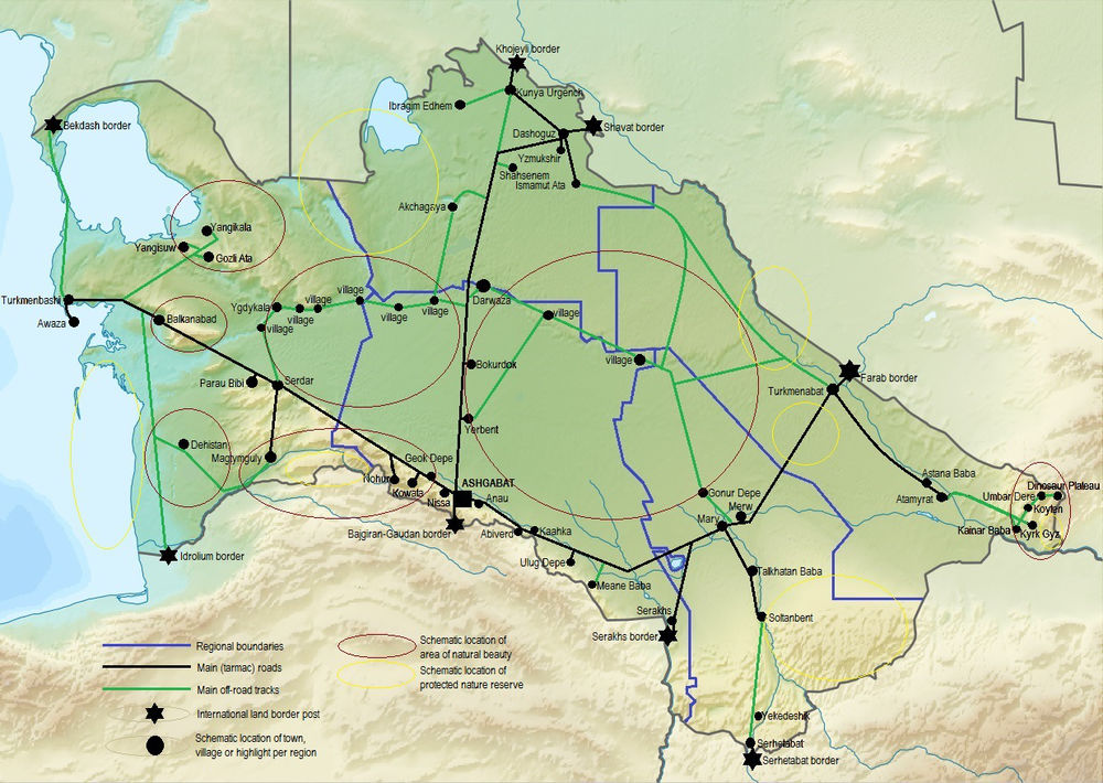
Turkmenistan borders Kazakhstan and Uzbekistan in the north and east, and Afghanistan and Iran in the south. The country is big: Turkmenistan covers an area of 492,000 square km. It stretches for 1100 km from west to east- from the Caspian Sea to the Amu Darya River, and for 650 km from the Uzbek border in the north to the Iranian border in the south.
The major part of the country is occupied by the Karakum desert (350.000 sq km). 20 per cent of its territory is mountainous and 1 per cent is made up of riverine oases. The Kopetdag range is in the south of Turkmenistan, while the Balkan Mountains are in the west and the Kugitang (or Koytendag) Range is in the east.
Turkmenistan is rich in mineral resources. It possesses the world’s fourth- largest reserves of natural gas and substantial oil resources. Turkmenistan is also a major cotton producer, and has a growing textile industry.
 Click anywhere inside the region of your choice to be redirected to the highlights in this region
Click anywhere inside the region of your choice to be redirected to the highlights in this region
click on a black dot of your choice to be redirected to the regional highlight listings in which the relevant highlight is located